|
Tara is located in western Serbia. It is a part of Dinaric Alps and
covers an area of
183 km2. Its length is 50 km, and it is 22 km wide, with
average height of 1200 m above sea level. Its highest point is Kozji
rid - 1591 m.
The location of Tara
allows development of tourism and visits to variety of different
tourist locations. Richness and variety of tourist attractions,
preserved natural environment, mountain relief with height between
800-1500 m, winter sports facilities, richness and variety of plant
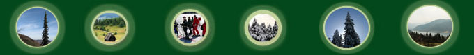
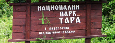
and animal life, pleasant climate, river Drina and artificial lakes
Perućac and Zaovine make this mountain one of the most beautiful in
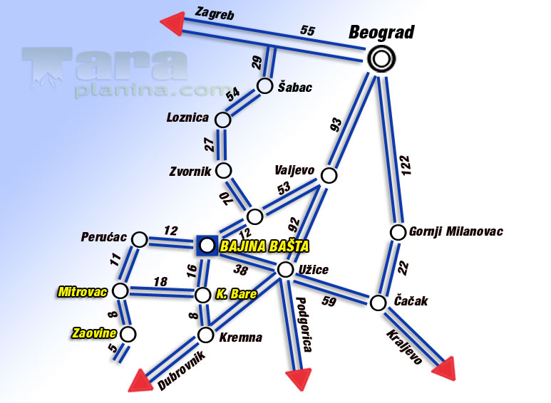
our country. Tara is situated in the vicinity of places such are
town of Uzice, Mokra Gora, town of Višegrad
with numerous cultural and historical sights which can be easily
visited by people who are staying on Tara. This gives them
opportunity for more interesting vacations. Tara gives excellent
opportunities for development of sustainable tourism with minimal
impact on its environment and cultural heritage, which helps
economical development of local community at the same time.
Tara is
a good place for building tourist objects. There are lots of places
with great amount of sunshine and little wind. During winter you can
engage in beginner or Nordic skiing or
sleighing. Opportunities for alpine skiing are limited due to
shortness of chutes, which is less than 2 km.
The best chutes
are in the region of
Predov krst. They are between 3 and 5 km
long. Mild steeps of Tara are good for walking, horse riding, using
trim traces and other sport
activities. |
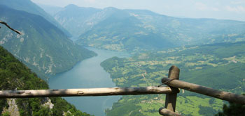
On July the 13. 1981. Tara becomes a National park covering area of
19.175 ha.
Due to its climate and isolation Tara preserved ancient species of
trees such as pancic spruce and other almost fossil species of
plants. Tara is mostly made of limestone and its average height is
1000-1200m. The highest point is Kozji Rid -1591m and the lowest
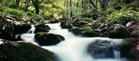
291m is at the lake Perućac. Vrelo River is the strongest fountain
in the national park, which runs into river Drina after 365 meters.
Summers are fresh and winters are cold with lots of snow. Most
rainfall is in May. Driest months are July and August. Autumn is
sunny and warmer then spring.
NP Tara is 80% covered with forests. There are 34 forest and 19
meadow communities. 75% of forests are mixed spruce-fir, fir and
beech. Besides Pančić spruce significant plants are hazel, yew,
holly, jeremičak, knapweed of derventa, peony, blechnum spicant
There are 53 species of mammals.
The most interesting are
bear (Ursus arctos), and chamois (Rupicapra rupicapra)
which lives even on
elevation of 291m. There are 135 species of birds. 43 of them are
migrating species. The most interesting are endangered species such
are golden eagle (Aquila chryssetos),
peregrine falcon and others.
There are more than 251 species of mushrooms. Three of them are
poisonous. Amanita phalloides is the most dangerous mushroom
in Europe.
Fishing on rivers
and lakes within the NP is a real pleasure. There are about 40
species of fish. (mladica (Hucho – hucho), lipljan
(Thumallus thumallus), gull, carp, jez (Leuciscus idus)…
In the NP Tara there are many archeological sights dating from
neolith to middle ages. There are stecaks in Perucac, remnants of
medieval fortress Solotnik and monastery Rača, built by king
Dragutin Nemanjić in the 13. century.
There are 18 mountain foot paths with total length of 120km. When
using those paths you should consult maps which can be bought at
information points in the park.
TAROCYKL
project defined 27 cycling paths with total length of about 420km
creating opportunity for a new kind of tourism with no side effects
on environment.
Hunting in the NP Tara is always organized according to plans. There are about 40 bears,
300 chamois, 320 does and 40 wild boars. Hunting licenses, guides
and transportation are authorized by service for protection and
improvement oh hunting and fishing of NP Tara.
You can find more about national park on
www.tara.org.yu |